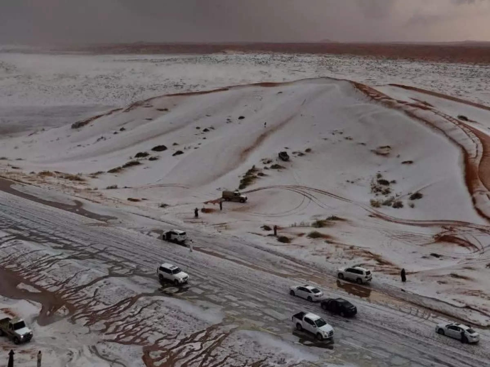
Northern regions of Saudi Arabia experienced a significant and sharp drop in temperatures on Monday morning, January 5th, with the governorates of Tarif and Rafha recording the lowest temperatures at one degree Celsius , reflecting the peak of winter in the northern areas. Meanwhile, other regions are bracing for thunderstorms and strong winds that may reduce horizontal visibility.
Minimum temperatures in the cities of the Kingdom
According to the data released, Tarif and Rafha were not the only cities affected by the cold wave; the drop included several other cities, with the recorded temperatures being as follows:
- Arar and Hafr Al-Batin: Two degrees Celsius.
- Al Qurayyat: 3 degrees Celsius.
- Al-Jawf region: 4 degrees Celsius.
- Hail, Khamis Mushait, and Abha: 5 degrees Celsius.
This decrease is a natural result of the geographical location of the northern regions, which are the first gateway to receive cold air masses coming from the north, making them vulnerable to waves of frost and extreme cold during the months of January and February of each year.
Rain and strong wind forecast
The National Center for Meteorology explained in its daily report that there is a chance – God willing – of thunderstorms accompanied by active winds that will stir up dust and sand. This weather pattern will be concentrated over parts of the Al-Baha and Makkah , with its effects extending to the southern parts of the Madinah highlands.
The report also indicated that cold to very cold weather would persist across large parts of the Hail, Al-Jawf, and Northern Borders regions, with the cold air mass extending to the northern parts of the Eastern Province. This would be accompanied by active surface winds that could reduce horizontal visibility due to dust and sandstorms, particularly in parts of Tabuk, Madinah, and Makkah, extending to the eastern parts of the southwestern highlands of the Kingdom.
Sea conditions and maritime navigation
In terms of maritime navigation, the Red Sea surface winds with speeds ranging between 20 and 40 km/h, and may reach 50 km/h with the formation of rain-bearing thunderclouds over the central and southern parts, leading to a rise in wave height of one to two meters and sometimes more. The sea state is light to moderate, and reaches rough during thunderstorms.
In the Arabian Gulf , the winds will be northwesterly to northeasterly at a speed of 20-40 km/h, with wave heights ranging between one and two meters, and the sea state will be light to moderate.
The importance of caution
Due to these weather fluctuations, experts advise wearing heavy winter clothing, especially for children and the elderly in the northern and central regions, and exercising caution while driving on highways experiencing wind and dust activity, in addition to avoiding going to sea in areas experiencing thunderstorms and high waves to ensure public safety.