Weather forecast for Saudi Arabia today, Wednesday
The National Center for Meteorology issued its daily weather forecast for Wednesday across Saudi Arabia, indicating the continuation of the unstable weather conditions currently affecting the country. The report stated that the chance of moderate to heavy thunderstorms remains, potentially accompanied by hail and strong winds that could lead to flash flooding in some areas.
The areas most affected by this rainy weather include parts of Makkah, Al-Baha, Asir, and Jazan. The center also warned of the possibility of dense fog forming during the night and early morning hours over the mountainous areas in these regions, as well as parts of northern Saudi Arabia, which could lead to a significant decrease in horizontal visibility.
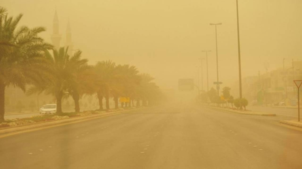
Active winds and dust storms in the north and central regions
In a related context, the center predicted that large parts of the Northern Borders, Al-Jawf, Eastern Province, and Riyadh regions would be affected by active surface winds that would stir up dust and sand, reducing visibility. These effects would extend to the Madinah region and the southern parts of the Tabuk region. For the Riyadh region, the center issued a special warning of active winds and dust storms starting at 9:00 AM and continuing until 6:00 PM, including the capital city of Riyadh and the governorates of Al-Zulfi, Al-Ghat, Al-Majma'ah, Shaqra, and others, with wind speeds that could reach 49 kilometers per hour.
Understanding the climatic context: Typical seasonal fluctuations
These weather phenomena are part of the Kingdom's climatic pattern, particularly during seasonal transitions when different air masses converge. The meeting of humid air masses from the south with cold air masses from the north leads to atmospheric instability, which explains the formation of dense thunderstorms and heavy rainfall. This time of year is considered a period of high activity for such fluctuations, necessitating continuous monitoring of warnings issued by official authorities.
Expected effects and public safety guidelines
This weather condition has direct impacts on daily life and public safety. Heavy rainfall in mountainous areas increases the risk of flash floods in valleys and ravines, posing a danger to hikers and road users. Dust-laden winds also negatively affect those with respiratory illnesses and asthma, and reduce visibility on highways, requiring drivers to exercise extreme caution. The Civil Defense Directorate advises citizens and residents to stay away from valleys and floodplains, and to continuously monitor warnings and instructions.
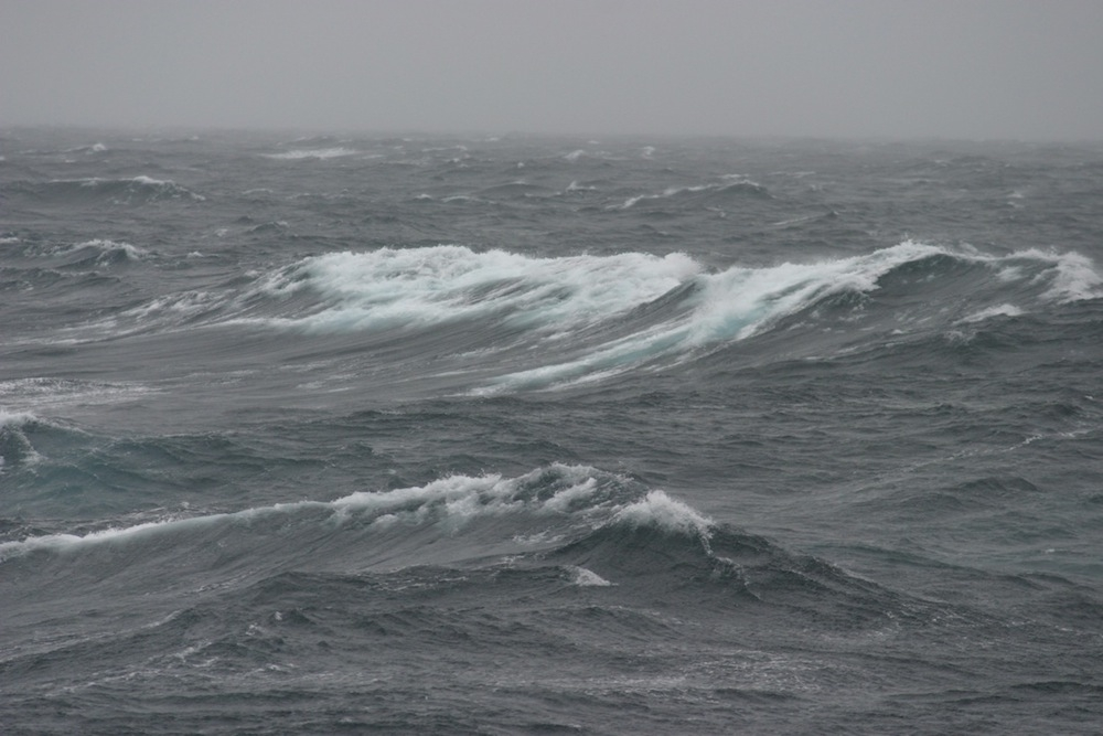
Sea conditions and maritime navigation
Red Sea: Surface winds will be northwesterly to northerly in the northern and central parts, and southerly in the southern part, with speeds reaching up to 50 km/h and the formation of thunderstorms. Wave heights will range from one to two meters, potentially exceeding two and a half meters with thunderstorms in the south, resulting in a moderate to rough sea state.
Arabian Gulf: Surface winds are southwesterly to northwesterly at speeds of up to 33 km/h, and wave heights range from half a meter to one and a half meters, making the sea state slight to moderate.