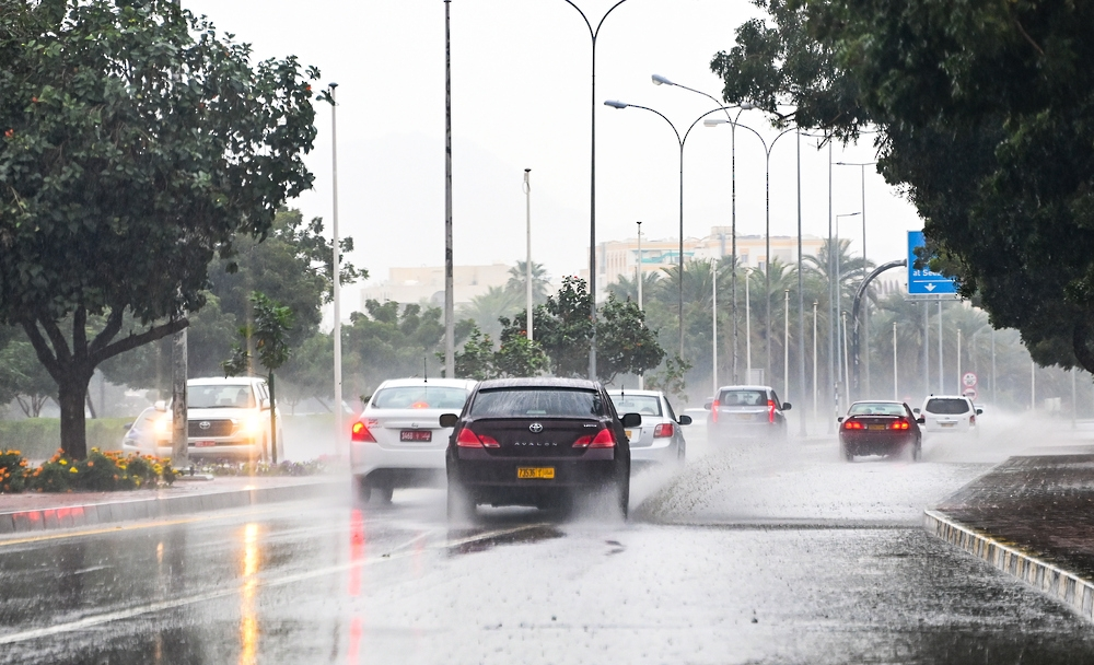
The National Center for Meteorology in Saudi Arabia issued its daily weather forecast for Friday, warning of continued atmospheric instability across most of the Kingdom. The forecast indicates moderate to heavy thunderstorms, which may lead to flash floods and be accompanied by hail and strong winds that will reduce horizontal visibility.
Weather details and affected areas
According to the center's statement, the affected areas primarily include parts of the Madinah, Qassim, Hail, Tabuk, Al-Jawf, and Northern Borders regions. These effects are expected to extend to the northern parts of the Eastern Province. Light rain is also expected in parts of the highlands in the western and southwestern regions of the Kingdom. The center warned that active winds stirring up dust and sand may lead to near-zero horizontal visibility in parts of these regions, as well as parts of the Riyadh region.
The climatic context of these weather fluctuations
This weather pattern occurs during a transitional period in the Arabian Peninsula with the arrival of spring, known climatologically as the "Marawih" or "Sarayat" season. This period is characterized by the activity of low-pressure systems originating from the Mediterranean basin, which converge with warm, humid air masses from the south, creating ideal conditions for the formation of cumulonimbus clouds and sudden, heavy rainfall. The diverse topography of the Kingdom, from towering mountains in the west to vast deserts in the central and eastern regions, plays a significant role in determining the intensity and distribution of these weather phenomena.
Importance and expected effects
These rains are of great importance to the Kingdom, as they contribute to replenishing groundwater reservoirs and supporting the agricultural sector. However, they also pose a significant challenge. The heavy rainfall can lead to flash floods in valleys and low-lying areas, threatening lives and property. Therefore, relevant authorities, such as the Civil Defense and the National Center for Meteorology, emphasize the need for caution, urging people to stay away from flood channels and to follow the continuously issued alerts and warnings to ensure everyone's safety. The accompanying dust storms also affect those with respiratory illnesses and sometimes disrupt land and air transportation.
The state of the Red Sea and the Arabian Gulf
Red Sea
- Surface winds: Southwesterly to northwesterly in the northern part at speeds of 15-40 km/h, reaching up to 60 km/h with the formation of thunderstorms and rain. Southeasterly to southwesterly in the central and southern parts at speeds of 20-45 km/h.
- Wave height: from half a meter to one and a half meters, reaching over two and a half meters with the formation of rain-bearing thunderclouds in the northern part. From one and a half to two and a half meters in the central and southern parts.
- Sea state: Slight to moderate waves in the north, becoming rough with thunderstorms. Moderate to rough in the central and southern parts.
Arabian Gulf
- Surface winds: Northerly to northwesterly, gradually shifting to southeasterly at 10-30 km/h, reaching up to 50 km/h with the formation of rain-bearing thunderstorms over the northern part. Southeasterly to southwesterly at 10-25 km/h over the southern part.
- Wave height: from half a meter to one meter, reaching more than two and a half meters with the formation of rain-bearing thunderclouds over the northern part.
- Sea conditions: Light to moderate waves, becoming rough with the formation of rain-bearing thunderclouds.