The National Center for Meteorology issued its daily weather forecast for Sunday across Saudi Arabia, indicating the continuation of the unstable weather conditions currently affecting the country. The center predicted thunderstorms, fog formation, and active surface winds that will stir up dust and sand in various parts of the Kingdom, necessitating increased caution.
Details of the expected weather conditions in the regions
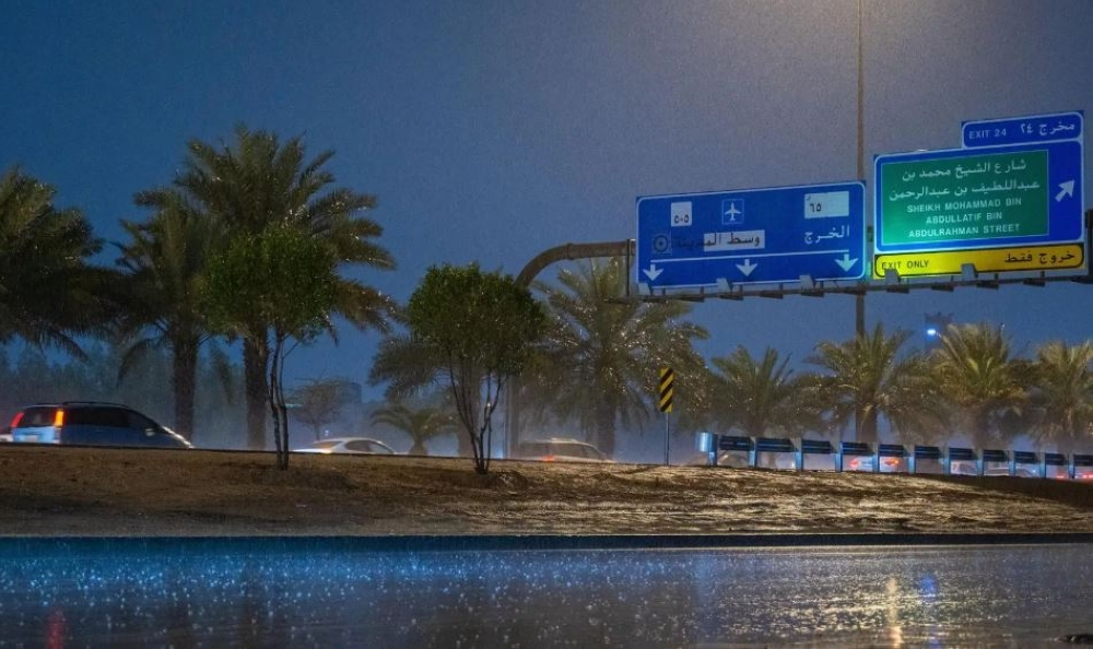
According to the center's statement, the chance of moderate to heavy thunderstorms, possibly accompanied by hail and strong winds, remains high in parts of the Eastern Province. The center also anticipates the formation of dense fog during the night and early morning hours in parts of the region, which could significantly reduce horizontal visibility. Meanwhile, the impact of strong winds stirring up dust and sand, which further reduces horizontal visibility, continues in parts of the Al-Jawf and Northern Borders regions. This necessitates caution, especially for those with respiratory conditions and drivers on highways.
Understanding the climatic context of weather fluctuations
These forecasts come within the context of the transitional period the Kingdom's climate is experiencing, which separates winter and spring. This period is typically characterized by unstable weather systems due to the convergence of different air masses: cold air from the north and warm, humid air from the south. This convergence creates volatile weather conditions, leading to the formation of thunderstorms and rainfall of varying intensity, in addition to increased surface wind activity. The National Center of Meteorology plays a vital role in monitoring these climatic changes and issuing early warnings, thus contributing to enhanced public safety and enabling relevant authorities, such as Civil Defense and Highway Patrol, to take the necessary precautions to deal with any emergencies that may arise from these weather conditions.
Expected effects and the importance of following guidelines
This weather condition has direct implications for the daily lives of residents. Heavy rainfall may lead to flash floods in valleys and low-lying areas, while fog and dust reduce visibility, increasing the risk of traffic accidents. Authorities urge citizens and residents to follow the alerts issued by the National Center of Meteorology, adhere to the instructions of the Civil Defense, avoid approaching water accumulations and flood channels, and exercise caution while driving.
Sea conditions and navigation
The report also referred to the situation in the Red and Arabian Seas, where maritime traffic is expected to be affected by these conditions.
Red Sea
- Surface winds: Northwesterly to northerly on the northern and central parts at a speed of 10-25 km/h, and southeasterly to southwesterly on the southern part at a speed of 12-35 km/h.
- Wave height: from half a meter to one and a half meters.
- Sea state: Light to moderate waves.
Arabian Gulf
- Surface winds: Southeasterly to southerly over the northern and central parts at a speed of 15-38 km/h, and northeasterly to easterly turning southwesterly to westerly in the evening over the southern part at a speed of 12-28 km/h, which may reach 50 km/h with the formation of rain-bearing thunderclouds.
- Wave height: from half a meter to one and a half meters, and may reach more than two meters with thunderstorms.
- Sea state: Light to moderate waves, possibly choppy with the formation of thunderclouds.